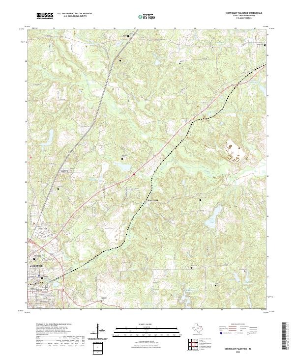
2022 Map of Northeast Palestine
USGS Topo · Published 2022About this map
Palestine serves as the focal point for this Anderson County survey, situated in a landscape defined by an intricate network of creeks and man-made water bodies. The northeastern expansion of the city is evident, where residential streets give way to the rural character of Wells Creek. This area is particularly dense with historic burial grounds, ranging from the large Roselawn Park Cem and Memorial Cem near the city center to smaller, family-named sites like Price Cem and Blackshire Cem further afield. The terrain is crisscrossed by numerous county roads and farm-to-market routes that connect isolated homesteads to the municipal core. Water features such as Lost Prairie Lake, Jackson Lake, and McDonald Lake illustrate a landscape heavily modified for water management and recreation, while Hurricane Cr and Mound Prairie Cr define the natural drainage patterns of the region.
Find a feature on this map
107 named features on this map. Tap any name to fly to it.
Don’t see what you’re looking for? This feature index may not catch every label — zoom into the map to look around manually.
Map Details
Editions of this 2022 Northeast Palestine Map
This is the sole edition of this map. No revisions or reprints were ever made.
Other maps of this area

1949 · Palestine
USGS Topo · 1:62,500

1950 · Palestine
USGS Topo · 1:62,500

1951 · Elkhart
USGS Topo · 1:62,500

1951 · Jacksonville
USGS Topo · 1:62,500

1952 · Slocum
USGS Topo · 1:62,500

1953 · Palestine
USGS Topo · 1:250,000

1957 · Palestine
USGS Topo · 1:250,000

1981 · Palestine
USGS Topo · 1:100,000
1982 · Northwest Palestine
USGS Topo · 1:24,000
1982 · Wilkerson Mountain
USGS Topo · 1:24,000