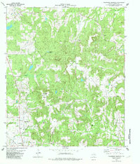
1982 Map of Wilkerson Mountain
USGS Topo · Published 1982About this map
Wilkerson Mountain rises as a prominent landmark in this portion of Anderson County, anchoring a landscape defined by small rural settlements and family-named cemeteries. The 1980s terrain shows a pattern of dispersed community life at Montalba and Elmwood, while the Plentitude (Site) suggests a location where earlier structures once stood. Industry is represented by an active Oil Field and scattered drill holes, indicating the region's energy development alongside traditional land use.
Find a feature on this map
32 named features on this map. Tap any name to fly to it.
Don’t see what you’re looking for? This feature index may not catch every label — zoom into the map to look around manually.
Map Details
Editions of this 1982 Wilkerson Mountain Map
This is the sole edition of this map. No revisions or reprints were ever made.
Other maps of this area

1949 · Palestine
USGS Topo · 1:62,500

1949 · Frankston
USGS Topo · 1:62,500

1949 · Athens
USGS Topo · 1:62,500

1949 · Tennessee Colony
USGS Topo · 1:62,500

1950 · Athens
USGS Topo · 1:62,500

1950 · Palestine
USGS Topo · 1:62,500

1950 · Frankston
USGS Topo · 1:62,500

1950 · Tennessee Colony
USGS Topo · 1:62,500

1953 · Palestine
USGS Topo · 1:250,000

1956 · Tyler
USGS Topo · 1:250,000