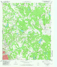
1982 Map of Northeast Palestine
USGS Topo · Published 1982About this map
The city of Palestine anchors the southwestern corner of this survey, where the Missouri Pacific railroad lines converge. The area is dense with sites of genealogical importance, including numerous family and community burial grounds such as East Hill Hill Cem, Roselawn Park Cem, and Blackshire Cem. Educational history is well-represented by the Zion Hill Sch, Northside Sch, and Sam Houston Sch, suggesting a community structured around small, local school districts.
Find a feature on this map
46 named features on this map. Tap any name to fly to it.
Don’t see what you’re looking for? This feature index may not catch every label — zoom into the map to look around manually.
Map Details
Editions of this 1982 Northeast Palestine Map
This is the sole edition of this map. No revisions or reprints were ever made.
Other maps of this area

1949 · Palestine
USGS Topo · 1:62,500

1950 · Palestine
USGS Topo · 1:62,500

1951 · Elkhart
USGS Topo · 1:62,500

1951 · Jacksonville
USGS Topo · 1:62,500

1952 · Slocum
USGS Topo · 1:62,500

1953 · Palestine
USGS Topo · 1:250,000

1957 · Palestine
USGS Topo · 1:250,000

1981 · Palestine
USGS Topo · 1:100,000
1982 · Northwest Palestine
USGS Topo · 1:24,000
1982 · Wilkerson Mountain
USGS Topo · 1:24,000