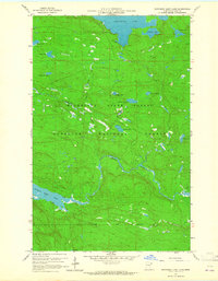
1959 Map of Northern Light Lake
USGS Topo · Published 1965About this map
Greenwood Lake and its surrounding boreal wilderness dominate this late-1950s survey of Cook County, Minnesota. The landscape is a dense network of water bodies and forests, situated where the Minnesota State Forest and Superior National Forest meet. The hydrology is complex, featuring the meandering Brule River and its connection to Northern Light Lake, alongside the Greenwood River and numerous smaller lakes with evocative names like Redcoat Lake, Woodpecker Lake, and Cyprinid Lake. Insight into the area's limited industrial activity is seen in a solitary Gravel Pit, while transportation is restricted to unimproved dirt roads and trails, including the route leading toward the Gunflint Trail. This map captures a pristine era for the Arrowhead Region, before modern development further altered the drainage patterns of the Section Ten Lake area.
Find a feature on this map
22 named features on this map. Tap any name to fly to it.
Don’t see what you’re looking for? This feature index may not catch every label — zoom into the map to look around manually.
Map Details
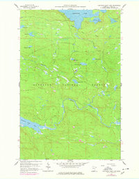
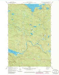
Editions of this 1959 Northern Light Lake Map
4 editions found
Other maps of this area

1954 · Two Harbors
USGS Topo · 1:250,000

1957 · Two Harbors
USGS Topo · 1:250,000

1957 · Quetico
USGS Topo · 1:250,000

1958 · Two Harbors
USGS Topo · 1:250,000

1959 · Northern Light Lake
USGS Topo · 1:24,000

1959 · Pine Mountain
USGS Topo · 1:24,000

1959 · Pine Lake East
USGS Topo · 1:24,000

1959 · Tom Lake
USGS Topo · 1:24,000

1959 · Pine Lake West
USGS Topo · 1:24,000

1959 · Crocodile Lake
USGS Topo · 1:24,000