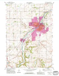
1991 Map of Northfield
USGS Topo · Published 1995About this map
The Cannon River valley serves as the central corridor for this region, anchoring the college town of Northfield and the neighboring settlement of Dundas. The landscape is defined by its educational institutions, with the expansive campuses of St Olaf College and Carleton College flanking the river. These academic grounds, including the picturesque Lyman Lakes, sit adjacent to a dense network of residential streets and civic landmarks like the Hospital and Armory.
Find a feature on this map
28 named features on this map. Tap any name to fly to it.
Don’t see what you’re looking for? This feature index may not catch every label — zoom into the map to look around manually.
Map Details
Editions of this 1991 Northfield Map
This is the sole edition of this map. No revisions or reprints were ever made.
Other maps of this area

1953 · Saint Paul
USGS Topo · 1:250,000

1957 · Farmington
USGS Topo · 1:62,500

1957 · Prior Lake
USGS Topo · 1:62,500

1959 · Saint Paul
USGS Topo · 1:250,000

1960 · Faribault
USGS Topo · 1:24,000

1960 · Northfield
USGS Topo · 1:24,000

1960 · Cannon City
USGS Topo · 1:24,000

1960 · Dennison
USGS Topo · 1:24,000

1960 · Little Chicago
USGS Topo · 1:24,000

1960 · Nerstrand
USGS Topo · 1:24,000