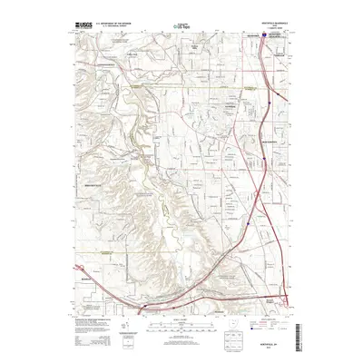
2013 Map of Northfield
USGS Topo · Published 2013About this map
The Cuyahoga Valley National Park dominates this landscape, preserving the corridor of the Cuyahoga River between the suburban expansions of Northfield and Brecksville. The map details the complex intersection of natural features and historic infrastructure, notably the Tinkers Creek Aqueduct and the Station Road Bridge near the Cuyahoga and Summit county line. The terrain is marked by significant hydrological landmarks such as Blue Hen Falls, Buttermilk Falls, and Bridal Veil Falls, illustrating the steep descent of tributaries into the river valley.
Find a feature on this map
42 named features on this map. Tap any name to fly to it.
Don’t see what you’re looking for? This feature index may not catch every label — zoom into the map to look around manually.
Map Details
Editions of this 2013 Northfield Map
This is the sole edition of this map. No revisions or reprints were ever made.
Other maps of this area

1903 · Cleveland
USGS Topo · 1:62,500

1903 · Akron
USGS Topo · 1:62,500

1905 · Akron
USGS Topo · 1:62,500

1906 · Kent
USGS Topo · 1:62,500

1906 · Chagrin Falls
USGS Topo · 1:62,500

1908 · Chagrin Falls
USGS Topo · 1:62,500

1950 · Cleveland
USGS Topo · 1:250,000

1953 · Chagrin Falls
USGS Topo · 1:24,000

1953 · Shaker Heights
USGS Topo · 1:24,000

1953 · Broadview Heights
USGS Topo · 1:24,000