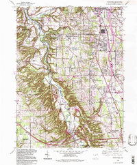
1994 Map of Northfield
USGS Topo · Published 1997About this map
The Cuyahoga Valley serves as the dominant geographic and cultural corridor of this region, home to the sprawling Cuyahoga Valley National Recreation Area. By the mid-1990s, the landscape reflects a complex layering of conservation, recreation, and suburban expansion across the Cuyahoga and Summit County line. The historic path of the Ohio Canal and the meandering Cuyahoga River contrast with the modern growth of Northfield, Macedonia, and Sagamore Hills.
Find a feature on this map
50 named features on this map. Tap any name to fly to it.
Don’t see what you’re looking for? This feature index may not catch every label — zoom into the map to look around manually.
Map Details
Editions of this 1994 Northfield Map
This is the sole edition of this map. No revisions or reprints were ever made.
Other maps of this area

1903 · Cleveland
USGS Topo · 1:62,500

1903 · Akron
USGS Topo · 1:62,500

1905 · Akron
USGS Topo · 1:62,500

1906 · Kent
USGS Topo · 1:62,500

1906 · Chagrin Falls
USGS Topo · 1:62,500

1908 · Chagrin Falls
USGS Topo · 1:62,500

1950 · Cleveland
USGS Topo · 1:250,000

1953 · Chagrin Falls
USGS Topo · 1:24,000

1953 · Shaker Heights
USGS Topo · 1:24,000

1953 · Broadview Heights
USGS Topo · 1:24,000