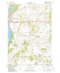
1974 Map of Northline
USGS Topo · Published 1977About this map
The St Croix River and St Croix Lake form the western boundary of this landscape, where the city of Hudson and North Hudson are established amidst a network of transportation and rural industry. The Chicago and North Western railroad bisects the terrain, meeting at the local junction of Northline and continuing east toward Sno Junction. This mid-1970s survey illustrates a community in transition, with newer developments like the Hudson Country Club and Wayside Park appearing alongside legacy features such as the Old Railroad Grade and Stage Line Road.
Find a feature on this map
33 named features on this map. Tap any name to fly to it.
Don’t see what you’re looking for? This feature index may not catch every label — zoom into the map to look around manually.
Map Details
Editions of this 1974 Northline Map
This is the sole edition of this map. No revisions or reprints were ever made.
Other maps of this area

1946 · Hudson
USGS Topo · 1:62,500

1946 · River Falls
USGS Topo · 1:62,500

1948 · New Richmond
USGS Topo · 1:62,500

1948 · Stillwater
USGS Topo · 1:62,500

1949 · New Richmond
USGS Topo · 1:62,500

1949 · River Falls
USGS Topo · 1:62,500

1949 · Hudson
USGS Topo · 1:62,500

1949 · Stillwater
USGS Topo · 1:62,500

1949 · Hudson
USGS Topo · 1:24,000

1950 · Hudson
USGS Topo · 1:24,000