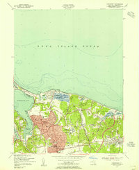
1954 Map of Northport
USGS Topo · Published 1955About this map
Northport and its neighboring harbors on the north shore of Long Island appear here during a period of significant mid-century suburban expansion. The map details the dense residential clusters emerging around East Northport and Kings Park, contrasting with the institutional footprints of the Northport Veterans Hospital and Central State Hosp. Along the coast, the narrow strip of Asharoken Beach connects the mainland to the northern reaches of Eatons Neck, while the Yacht Club and several tidal flats characterize the maritime activity within Northport Harbor and Centerport Harbor.
Find a feature on this map
52 named features on this map. Tap any name to fly to it.
Don’t see what you’re looking for? This feature index may not catch every label — zoom into the map to look around manually.
Map Details
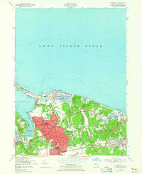
Editions of this 1954 Northport Map
2 editions found
Other maps of this area

1891 · Bridgeport
USGS Topo · 1:62,500

1892 · Norwalk
USGS Topo · 1:62,500

1893 · Bridgeport
USGS Topo · 1:62,500

1893 · Norwalk
USGS Topo · 1:62,500

1901 · Northport
USGS Topo · 1:62,500

1902 · Setauket
USGS Topo · 1:62,500

1903 · Northport
USGS Topo · 1:62,500

1904 · Setauket
USGS Topo · 1:62,500

1904 · Islip
USGS Topo · 1:125,000

1919 · Setauket
USGS Topo · 1:62,500