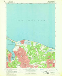
1967 Map of Northport
USGS Topo · Published 1968About this map
Northport Harbor and Northport Bay anchor this coastal survey, showing the North Shore of Long Island during a period of established residential growth and institutional development. The village of Northport is the primary hub, surrounded by smaller settlements like Centerport, Fort Salonga, and Kings Park. The landscape is characterized by a mix of recreational and public spaces, including the expansive Sunken Meadow State Park and the Northport Veterans Hospital complex.
Find a feature on this map
45 named features on this map. Tap any name to fly to it.
Don’t see what you’re looking for? This feature index may not catch every label — zoom into the map to look around manually.
Map Details
Editions of this 1967 Northport Map
2 editions found
Other maps of this area

1891 · Bridgeport
USGS Topo · 1:62,500

1892 · Norwalk
USGS Topo · 1:62,500

1893 · Bridgeport
USGS Topo · 1:62,500

1893 · Norwalk
USGS Topo · 1:62,500

1901 · Northport
USGS Topo · 1:62,500

1902 · Setauket
USGS Topo · 1:62,500

1903 · Northport
USGS Topo · 1:62,500

1904 · Setauket
USGS Topo · 1:62,500

1904 · Islip
USGS Topo · 1:125,000

1919 · Setauket
USGS Topo · 1:62,500