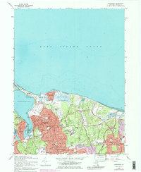
1967 Map of Northport
USGS Topo · Published 1979About this map
The deep indentation of Northport Harbor and Northport Bay anchors this coastal area, where the maritime character of the Suffolk County shoreline meets post-war suburban development. The narrow neck of Asharoken Beach provides a tenuous connection for residents along Asharoken Ave heading toward Eatons Neck, while the mainland is defined by the heavy infrastructure of the Northport Veterans Hospital and the Powerplant near Crab Meadow.
Find a feature on this map
52 named features on this map. Tap any name to fly to it.
Don’t see what you’re looking for? This feature index may not catch every label — zoom into the map to look around manually.
Map Details
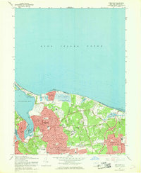
Editions of this 1967 Northport Map
2 editions found
Other maps of this area

1891 · Bridgeport
USGS Topo · 1:62,500

1892 · Norwalk
USGS Topo · 1:62,500

1893 · Bridgeport
USGS Topo · 1:62,500

1893 · Norwalk
USGS Topo · 1:62,500

1901 · Northport
USGS Topo · 1:62,500

1902 · Setauket
USGS Topo · 1:62,500

1903 · Northport
USGS Topo · 1:62,500

1904 · Setauket
USGS Topo · 1:62,500

1904 · Islip
USGS Topo · 1:125,000

1919 · Setauket
USGS Topo · 1:62,500