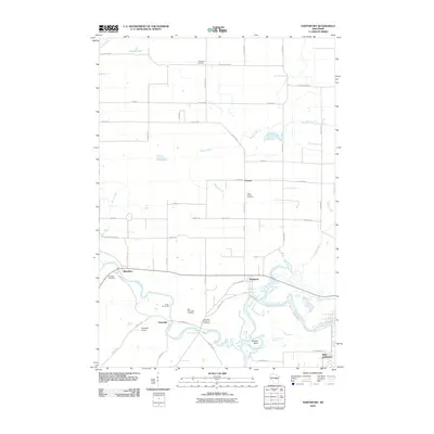
2010 Map of Northport
USGS Topo · Published 2010About this map
The Wolf River and Little Wolf River converge in this corner of Waupaca County, defining a landscape of low-lying wetlands and meandering waterways. The settlement of Northport sits at the junction of Weyauwega Rd and County Hwy X, near the distinctive river bend known as Shirttail Bend. To the west, the village of Royalton serves as a secondary hub, while the small community of Ostrander is situated between the two rivers.
Find a feature on this map
55 named features on this map. Tap any name to fly to it.
Don’t see what you’re looking for? This feature index may not catch every label — zoom into the map to look around manually.
Map Details
Editions of this 2010 Northport Map
This is the sole edition of this map. No revisions or reprints were ever made.
Other maps of this area

1955 · Embarrass
USGS Topo · 1:48,000

1955 · Clintonville
USGS Topo · 1:48,000

1955 · Green Bay
USGS Topo · 1:250,000

1956 · New London
USGS Topo · 1:48,000

1956 · Weyauwega
USGS Topo · 1:48,000

1969 · New London
USGS Topo · 1:24,000

1969 · Readfield
USGS Topo · 1:24,000
1969 · Hortonville
USGS Topo · 1:24,000

1969 · Northport
USGS Topo · 1:24,000

1969 · Bear Creek
USGS Topo · 1:24,000