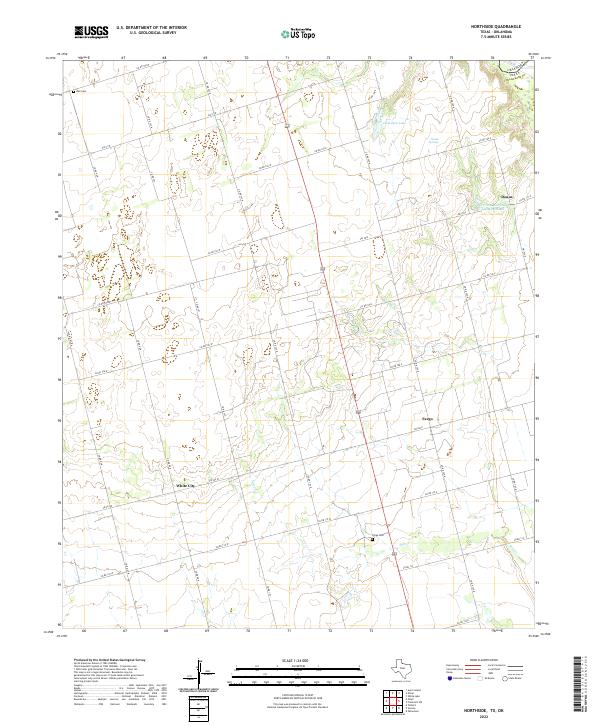
2022 Map of Northside
USGS Topo · Published 2022About this map
The Red River borderlands of North Texas are defined here by the small agricultural communities of Doans, Fargo, and White City. This landscape in Wilbarger County is shaped by a grid of farm-to-market roads and county routes that navigate the drainage of Salt Cr. The presence of Bell Cem and Fargo Cem serves as a grounded anchor for genealogical research, marking the historic centers of local settlement. Along the northern edge, water features like Hamilton Lake, Doans Springs, and the Vernon Rod and Gun Club Lake stand out against the terrain, illustrating the importance of reliable water sources in this part of the state. The map provides a clear look at the rural infrastructure and land divisions that have persisted near the Oklahoma border into the modern era.
Find a feature on this map
35 named features on this map. Tap any name to fly to it.
Don’t see what you’re looking for? This feature index may not catch every label — zoom into the map to look around manually.
Map Details
Editions of this 2022 Northside Map
This is the sole edition of this map. No revisions or reprints were ever made.
Other maps of this area

1955 · Lawton
USGS Topo · 1:250,000

1958 · Davidson
USGS Topo · 1:62,500

1958 · Frederick
USGS Topo · 1:62,500

1958 · Vernon
USGS Topo · 1:62,500

1958 · Elmer
USGS Topo · 1:62,500

1975 · Elmore City NE
USGS Topo · 1:24,000

1975 · Frederick SW
USGS Topo · 1:24,000

1975 · Frederick NW
USGS Topo · 1:24,000

1983 · Tolbert
USGS Topo · 1:24,000
1983 · Vernon
USGS Topo · 1:24,000