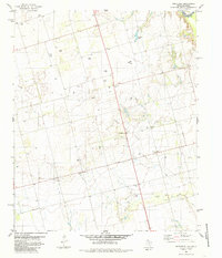
1985 Map of Northside
USGS Topo · Published 1985About this map
The Red River marks the northern boundary of this Texas panhandle landscape, defining the border between Wilbarger Co, Texas, and Elmer Co, Oklahoma. In the mid-1980s, the region was characterized by a dense network of extraction points within the Fargo Oil Field, where numerous wells are scattered across the plains surrounding the settlement of Fargo. This industrial footprint is interspersed with foundational community landmarks like the Fargo Ch and Fargo Cem, alongside the remote Bell Cem to the northwest.
Find a feature on this map
16 named features on this map. Tap any name to fly to it.
Don’t see what you’re looking for? This feature index may not catch every label — zoom into the map to look around manually.
Map Details
Editions of this 1985 Northside Map
This is the sole edition of this map. No revisions or reprints were ever made.
Other maps of this area

1955 · Lawton
USGS Topo · 1:250,000

1958 · Davidson
USGS Topo · 1:62,500

1958 · Frederick
USGS Topo · 1:62,500

1958 · Vernon
USGS Topo · 1:62,500

1958 · Elmer
USGS Topo · 1:62,500

1975 · Elmore City NE
USGS Topo · 1:24,000

1975 · Frederick SW
USGS Topo · 1:24,000

1975 · Frederick NW
USGS Topo · 1:24,000

1983 · Tolbert
USGS Topo · 1:24,000
1983 · Vernon
USGS Topo · 1:24,000