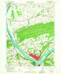
1965 Map of Northumberland
USGS Topo · Published 1967About this map
The confluence of the West Branch Susquehanna River and the main stem of the Susquehanna River anchors this 1965 survey, showing the strategic river-town geography of Northumberland and Sunbury. The landscape is dominated by the massive ridge of Montour Ridge, which forces the Chillisquaque Creek to meander significantly before joining the West Branch. Transportation patterns are defined by the Reading and Erie-Lackawanna railroads, which parallel the riverbanks and support established riverfront communities like Kapp Heights and Montandon.
Find a feature on this map
64 named features on this map. Tap any name to fly to it.
Don’t see what you’re looking for? This feature index may not catch every label — zoom into the map to look around manually.
Map Details
Editions of this 1965 Northumberland Map
4 editions found

Other maps of this area

1892 · Shamokin
USGS Topo · 1:62,500

1893 · Sunbury
USGS Topo · 1:62,500

1893 · Shamokin
USGS Topo · 1:62,500

1924 · Milton
USGS Topo · 1:62,500

1935 · Hughesville
USGS Topo · 1:62,500

1943 · Shamokin
USGS Topo · 1:62,500

1943 · Sunbury
USGS Topo · 1:62,500

1950 · Harrisburg
USGS Topo · 1:250,000

1952 · Shamokin
USGS Topo · 1:62,500

1953 · Hughesville
USGS Topo · 1:62,500
Featured Places
- Sunbury, PA
- Northumberland, PA
- Monroe Township, PA
- Upper Augusta Township, PA
- Lithia Springs, Point Township