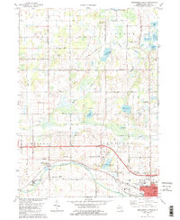
1980 Map of Northwest Albion
USGS Topo · Published 1980About this map
The Kalamazoo River winds through the southern portion of this landscape, flanked by the Conrail rail line and the settlement of Marengo. This 1980 survey reveals a community anchored by agricultural land and several rural churches, including the United Pentecostal Ch and the Chapel in the Woods. North of the river, the institutional campus of the Starr Commonwealth for Boys stands near Montalm Lake, while the northwestern reaches of Albion show the development of McIntosh Park and Austin Sch. Numerous family and pioneer burial grounds, such as Sampson Cem, Rice Creek Cem, and Dyer Cem, are scattered across the townships of Lee, Clarence, and Sheridan, offering significant data for genealogical research into the area's long-established residents. The northern half is defined by a dense network of glacial water bodies, including Winnipeg Lake, Halls Lake, and the cluster of lakes near Bolt Lake.
Find a feature on this map
48 named features on this map. Tap any name to fly to it.
Don’t see what you’re looking for? This feature index may not catch every label — zoom into the map to look around manually.
Map Details
Editions of this 1980 Northwest Albion Map
2 editions found
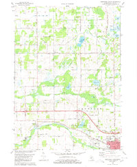
Other maps of this area

1919 · Springport
USGS Topo · 1:62,500

1921 · Springport
USGS Topo · 1:62,500

1921 · Marshall
USGS Topo · 1:62,500

1923 · Marshall
USGS Topo · 1:62,500

1943 · Marshall
USGS Topo · 1:62,500

1948 · Spring Arbor
USGS Topo · 1:62,500

1948 · Homer
USGS Topo · 1:62,500

1949 · Homer
USGS Topo · 1:62,500

1949 · Spring Arbor
USGS Topo · 1:62,500

1958 · Grand Rapids
USGS Topo · 1:250,000