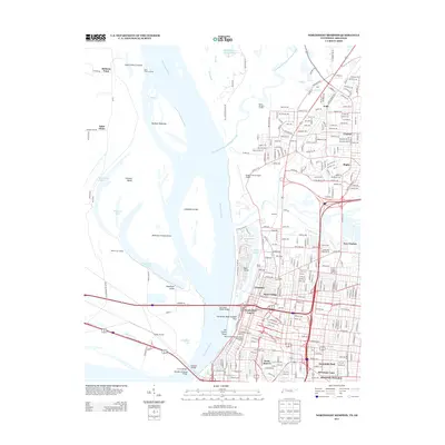
2013 Map of Northwest Memphis
USGS Topo · Published 2013About this map
Chickasaw Bluff Number Four anchors the riverfront in this 2013 survey, where the urban core of Memphis meets the complex hydrology of the Mississippi River. The map details the modern landscape of downtown and North Memphis, including historical areas like the Beale Street National Historic Preservation District and the Cotton Row Historic District. Significant residential and public housing developments such as Lauderdale Courts and Foote Homes are clearly delineated alongside older neighborhoods like Annesdale Park and Frayser.
Find a feature on this map
290 named features on this map. Tap any name to fly to it.
Don’t see what you’re looking for? This feature index may not catch every label — zoom into the map to look around manually.
Map Details
Editions of this 2013 Northwest Memphis Map
This is the sole edition of this map. No revisions or reprints were ever made.
Other maps of this area

1916 · Memphis
USGS Topo · 1:62,500

1925 · Memphis
USGS Topo · 1:48,000

1927 · Memphis
USGS Topo · 1:62,500

1931 · Jericho
USGS Topo · 1:62,500

1939 · Jericho
USGS Topo · 1:62,500

1939 · Memphis
USGS Topo · 1:62,500

1942 · Millington
USGS Topo · 1:62,500

1952 · Jericho
USGS Topo · 1:62,500

1953 · Memphis
USGS Topo · 1:250,000

1955 · Memphis
USGS Topo · 1:62,500