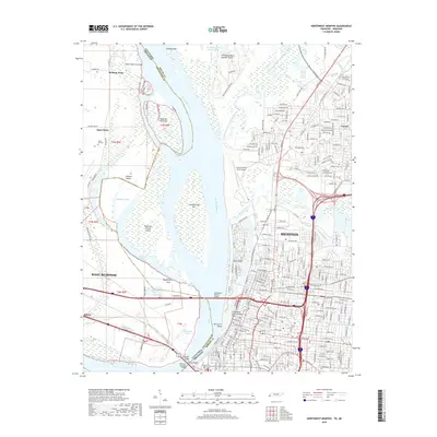
2019 Map of Northwest Memphis
USGS Topo · Published 2019About this map
The Mississippi River serves as the powerful divide between Tennessee and Arkansas in this detailed 2019 survey, defining the industrial and logistical heart of Memphis. The river's dynamic nature is evident in features like Saint Claire Crevasse, Hickman Bar, and the expansive Mud Island, which sits across from the city's historic core. On the Tennessee side, the landscape is densely packed with urban development, stretching from the neighborhoods of Frayser down through the central business district, where the BNSF Railway and major highways converge near the riverbank.
Find a feature on this map
238 named features on this map. Tap any name to fly to it.
Don’t see what you’re looking for? This feature index may not catch every label — zoom into the map to look around manually.
Map Details
Editions of this 2019 Northwest Memphis Map
This is the sole edition of this map. No revisions or reprints were ever made.
Other maps of this area

1916 · Memphis
USGS Topo · 1:62,500

1925 · Memphis
USGS Topo · 1:48,000

1927 · Memphis
USGS Topo · 1:62,500

1931 · Jericho
USGS Topo · 1:62,500

1939 · Jericho
USGS Topo · 1:62,500

1939 · Memphis
USGS Topo · 1:62,500

1942 · Millington
USGS Topo · 1:62,500

1952 · Jericho
USGS Topo · 1:62,500

1953 · Memphis
USGS Topo · 1:250,000

1955 · Memphis
USGS Topo · 1:62,500