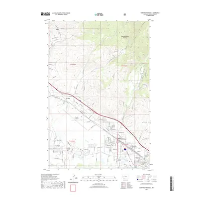
2020 Map of Northwest Missoula
USGS Topo · Published 2020About this map
Missoula sits at the confluence of urban development and the protected wilderness of the Lolo National Forest, which dominates the northern reaches of this quadrangle. The landscape is defined by the valley floor of the Clark Fork, where the intricate management of water is visible through historic irrigation structures like the Grass Valley French Ditch, Flynn Lowney Ditch, and Lehsou Ditch. To the west, the Missoula International Airport occupies a significant footprint, marking the area’s role as a regional transportation hub. Residential and commercial growth is evident along the W Broadway St corridor, stretching toward the settlement of De Smet. The northern elevation rises sharply into the North Hills, where naming conventions like Buffalo Speedway and Running Deer Ln suggest the transition from city streets to the higher, more open terrain near Nagos.
Find a feature on this map
150 named features on this map. Tap any name to fly to it.
Don’t see what you’re looking for? This feature index may not catch every label — zoom into the map to look around manually.
Map Details
Editions of this 2020 Northwest Missoula Map
This is the sole edition of this map. No revisions or reprints were ever made.
Other maps of this area

1903 · Bonner
USGS Topo · 1:125,000

1912 · Missoula
USGS Topo · 1:125,000

1921 · Elbow Lake
USGS Topo · 1:125,000

1947 · Butte
USGS Topo · 1:250,000

1955 · Choteau
USGS Topo · 1:250,000

1956 · Wallace
USGS Topo · 1:250,000

1956 · Hamilton
USGS Topo · 1:250,000

1957 · Choteau
USGS Topo · 1:250,000

1958 · Butte
USGS Topo · 1:250,000

1958 · Choteau
USGS Topo · 1:250,000