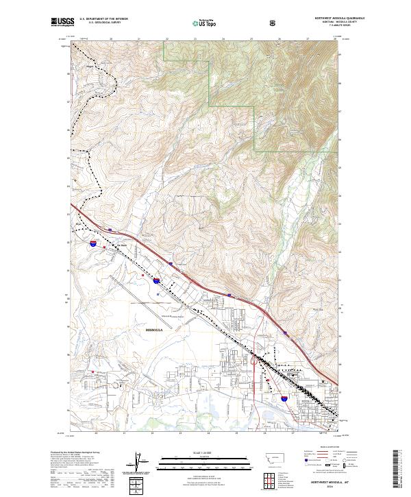
2024 Map of Northwest Missoula
USGS Topo · Published 2024About this map
The Missoula Montana Airport and its surrounding aviation-industrial corridor dominate the central valley of this 2024 landscape, highlighting the modern infrastructure of Missoula. To the north and east, the terrain transitions into the forested slopes of the Lolo National Forest and the rugged drainage of Grant Creek, while the valley floor is defined by a sophisticated system of irrigation features like the Grass Valley French Ditch and Flynn Lowney Ditch. These waterways underscore the enduring agricultural heritage of the region alongside burgeoning residential developments. Genealogists will find the eastern portion of the map particularly significant, as it clearly delineates several major burial sites, including Missoula Cem, New Saint Mary Cem, and Sunset Memorial Gardens. Small named settlements like De Smet and Nagos appear along the transport routes, reflecting the local settlement patterns that have expanded outward from the city center.
Find a feature on this map
159 named features on this map. Tap any name to fly to it.
Don’t see what you’re looking for? This feature index may not catch every label — zoom into the map to look around manually.
Map Details
Editions of this 2024 Northwest Missoula Map
This is the sole edition of this map. No revisions or reprints were ever made.
Other maps of this area

1903 · Bonner
USGS Topo · 1:125,000

1912 · Missoula
USGS Topo · 1:125,000

1921 · Elbow Lake
USGS Topo · 1:125,000

1947 · Butte
USGS Topo · 1:250,000

1955 · Choteau
USGS Topo · 1:250,000

1956 · Wallace
USGS Topo · 1:250,000

1956 · Hamilton
USGS Topo · 1:250,000

1957 · Choteau
USGS Topo · 1:250,000

1958 · Butte
USGS Topo · 1:250,000

1958 · Choteau
USGS Topo · 1:250,000