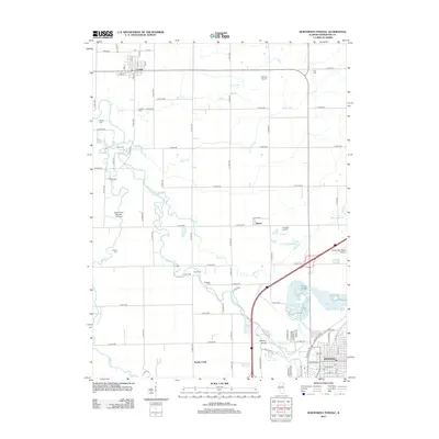
2012 Map of Northwest Pontiac
USGS Topo · Published 2012About this map
The Vermillion River carves a winding path through the heart of Livingston County, defining the agricultural landscape between the village of Cornell and the northern edge of Pontiac. This 2012 survey reveals a rural territory where historic burial grounds like Zooks Cem and Corbins Cem are preserved alongside modern infrastructure such as the Livingston Landfill and Pontiac Municipal Airport. The mapping of small drainage ways including Baker Run, Wolf Cr, and Ida Cr illustrates the complex hydrology required to support this productive prairie region. To the south, the river splits around Heisner Island before reaching the urban grid of Pontiac, where the confluence of Turtle Cr and The Slough meets the main channel near Rooks Creek. Several private and municipal airfields, including Pulliam Airport and Adams RLA Number 2 Airport, reflect the local importance of regional aviation.
Find a feature on this map
87 named features on this map. Tap any name to fly to it.
Don’t see what you’re looking for? This feature index may not catch every label — zoom into the map to look around manually.
Map Details
Editions of this 2012 Northwest Pontiac Map
This is the sole edition of this map. No revisions or reprints were ever made.
Other maps of this area

1925 · Streator
USGS Topo · 1:62,500

1927 · Streator
USGS Topo · 1:62,500

1935 · Pontiac
USGS Topo · 1:62,500

1939 · Pontiac
USGS Topo · 1:62,500

1958 · Flanagan
USGS Topo · 1:62,500

1958 · Odell
USGS Topo · 1:62,500

1958 · Aurora
USGS Topo · 1:250,000

1958 · Peoria
USGS Topo · 1:250,000

1961 · Aurora
USGS Topo · 1:250,000

1961 · Peoria
USGS Topo · 1:250,000