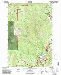
1994 Map of Northwestern Lake
USGS Topo · Published 1997About this map
White Salmon Wild and Scenic River defines the eastern boundary of this terrain, where the river's canyon cuts through a landscape shaped by timber and water management. In the mid-1990s, the small settlement at BZ Corner serves as a local hub near where Gilmer Creek meets the main river channel. The topography is dominated by high points like Nestor Peak Lookout and Little Baldy Peak Lookout, providing strategic vantage points over the Gifford Pinchot National Forest and the Monte Cristo Range.
Find a feature on this map
52 named features on this map. Tap any name to fly to it.
Don’t see what you’re looking for? This feature index may not catch every label — zoom into the map to look around manually.
Map Details
Editions of this 1994 Northwestern Lake Map
This is the sole edition of this map. No revisions or reprints were ever made.
Other maps of this area

1926 · Hood River
USGS Topo · 1:125,000

1929 · Hood River
USGS Topo · 1:125,000

1934 · The Dalles
USGS Topo · 1:125,000

1953 · The Dalles
USGS Topo · 1:250,000

1956 · The Dalles
USGS Topo · 1:250,000

1957 · The Dalles
USGS Topo · 1:250,000

1957 · Willard
USGS Topo · 1:62,500

1957 · White Salmon
USGS Topo · 1:62,500

1957 · Husum
USGS Topo · 1:62,500

1957 · Hood River
USGS Topo · 1:62,500