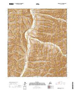
2017 Map of Norton Bay C-3 SE
USGS Topo · Published 2017About this map
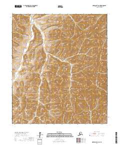
The Nulato Hills dominate this portion of the Nome Census Area, characterized by a series of high ridges and deep drainages in the Alaskan interior. Running primarily north to south through the center of the terrain, Kingmetolik Creek serves as the primary hydrological feature, carving a valley between the surrounding slopes. This 2017 study illustrates a landscape defined by natural topography rather than human settlement, showing the complex contour patterns of the hills and the winding path of the creek. The map provides a detailed view of the remote drainage systems and the high-elevation terrain that characterizes this part of the Seward Peninsula hinterland, capturing the area in its modern state before any significant development or infrastructure altered the traditional landscape.
Find a feature on this map
6 named features on this map. Tap any name to fly to it.
Don’t see what you’re looking for? This feature index may not catch every label — zoom into the map to look around manually.
Map Details
Editions of this 2017 Norton Bay C-3 SE Map
This is the sole edition of this map. No revisions or reprints were ever made.
Other maps of this area

1948 · Norton Bay
USGS Topo · 1:250,000

1950 · Norton Bay B-3
USGS Topo · 1:63,360

1950 · Norton Bay C-3
USGS Topo · 1:63,360

1951 · Norton Bay
USGS Topo · 1:250,000
1953 · Norton Bay B-2
USGS Topo · 1:63,360

1953 · Norton Bay C-2
USGS Topo · 1:63,360

1955 · Norton Bay
USGS Topo · 1:250,000
2017 · Norton Bay B-3 NW
USGS Topo · 1:25,000
2017 · Norton Bay C-3 NE
USGS Topo · 1:25,000
2017 · Norton Bay B-3 NE
USGS Topo · 1:25,000