
1950 Map of Norton Bay C-3
USGS Topo · Published 1958About this map
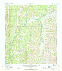
The Shaktoolik River winds through this subarctic interior landscape, carving a prominent valley across the terrain as it was recorded in the early 1950s. This survey, compiled from aerial photography by the Army Map Service, reveals a nearly untouched wilderness where human presence is marked only by a solitary Cabin situated near the southern reaches of the river’s main stem. Tributaries like Christmas Creek and the Guingmetolik Creek define the drainage patterns of the surrounding highlands. The lack of roads or trails noted by the Geological Survey during this period underscores the isolation of the region within the Norton Bay area, offering a precise look at the natural topography before any significant modern encroachment or infrastructure development in this portion of the Alaska interior.
Find a feature on this map
4 named features on this map. Tap any name to fly to it.
Don’t see what you’re looking for? This feature index may not catch every label — zoom into the map to look around manually.
Map Details
Editions of this 1950 Norton Bay C-3 Map
3 editions found
Other maps of this area

1948 · Norton Bay
USGS Topo · 1:250,000

1950 · Norton Bay B-4
USGS Topo · 1:63,360

1950 · Norton Bay D-4
USGS Topo · 1:63,360

1950 · Norton Bay B-3
USGS Topo · 1:63,360

1950 · Norton Bay D-3
USGS Topo · 1:63,360

1950 · Norton Bay C-4
USGS Topo · 1:63,360

1951 · Norton Bay
USGS Topo · 1:250,000
1953 · Norton Bay B-2
USGS Topo · 1:63,360

1953 · Norton Bay C-2
USGS Topo · 1:63,360

1954 · Norton Bay D-2
USGS Topo · 1:63,360