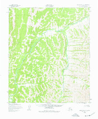
1950 Map of Norton Bay C-3
USGS Topo · Published 1977About this map
The Shaktoolik River winds through this subarctic landscape, providing a primary drainage system for the surrounding highlands as recorded in the 1950s. The terrain is defined by a dense network of tributaries and ridges, where Kingmetolik Creek joins the main river channel from the east. A solitary Cabin situated along the lower reach of the river represents the only mapped human structure in this expansive area, likely serving as a seasonal base for traditional subsistence activities or local travel. The presence of Christmas Creek further upstream highlights the family-named and local landmarks common to these remote interior corridors. The drainage patterns and topographic contours shown reflect a period before modern infrastructure, preserving the natural hydrological state of this portion of the Norton Bay region.
Find a feature on this map
4 named features on this map. Tap any name to fly to it.
Don’t see what you’re looking for? This feature index may not catch every label — zoom into the map to look around manually.
Map Details
Editions of this 1950 Norton Bay C-3 Map
3 editions found
Other maps of this area

1948 · Norton Bay
USGS Topo · 1:250,000

1950 · Norton Bay B-4
USGS Topo · 1:63,360

1950 · Norton Bay D-4
USGS Topo · 1:63,360

1950 · Norton Bay B-3
USGS Topo · 1:63,360

1950 · Norton Bay C-3
USGS Topo · 1:63,360

1950 · Norton Bay D-3
USGS Topo · 1:63,360

1950 · Norton Bay C-4
USGS Topo · 1:63,360

1951 · Norton Bay
USGS Topo · 1:250,000
1953 · Norton Bay B-2
USGS Topo · 1:63,360

1953 · Norton Bay C-2
USGS Topo · 1:63,360