
1950 Map of Norton Bay B-3
USGS Topo · Published 1958About this map
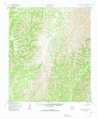
North River dominates the southeastern quadrant of this 1950 topographical study, illustrating the drainage patterns of the Seward Peninsula before extensive modern development. The landscape is defined by its complex waterway network, where Guingmetolik Creek and Anaktok Creek carve through the high elevations of the Norton Bay region. This survey was produced by the Army Map Service using photogrammetric methods from 1950 aerial photography, providing an unfiltered view of the terrain's natural state without the presence of roads or trails. Smaller tributaries such as Sardine Creek and Shovel Creek provide essential markers for understanding the historical hydrology of this corner of the Alaska-Second Judicial Division. The map's lack of human settlements underscores the isolation of the area during the mid-twentieth century, serving as a primary reference for the original names and paths of these northern Alaskan waters.
Find a feature on this map
5 named features on this map. Tap any name to fly to it.
Don’t see what you’re looking for? This feature index may not catch every label — zoom into the map to look around manually.
Map Details
Editions of this 1950 Norton Bay B-3 Map
2 editions found
Other maps of this area

1948 · Norton Bay
USGS Topo · 1:250,000

1950 · Norton Bay B-4
USGS Topo · 1:63,360

1950 · Norton Bay C-3
USGS Topo · 1:63,360

1950 · Norton Bay A-4
USGS Topo · 1:63,360

1950 · Norton Bay A-3
USGS Topo · 1:63,360

1950 · Norton Bay C-4
USGS Topo · 1:63,360

1951 · Norton Bay
USGS Topo · 1:250,000
1953 · Norton Bay B-2
USGS Topo · 1:63,360

1953 · Norton Bay C-2
USGS Topo · 1:63,360
1953 · Norton Bay A-2
USGS Topo · 1:63,360