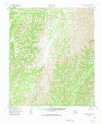
1950 Map of Norton Bay B-3
USGS Topo · Published 1975About this map
Drainage patterns and high-latitude relief define this 1950 landscape within the North River watershed. The terrain is characterized by a dense network of headwaters and tributaries, including Kingmetolik Creek and Egavik Creek, which carve through the unsurveyed interior. While the map notes that land lines were predetermined by the Bureau of Land Management, the lack of roads or established trails on this sheet reflects the wilderness character of the region during the post-war era. The survey, produced by the Army Map Service and published by the Geological Survey, meticulously tracks the courses of smaller seasonal flows like Anakeksik Creek, Sardine Creek, and Shovel Creek as they navigate the ridges and valleys typical of the Norton Bay hinterlands. This sheet provides a baseline of the natural geography before later development or environmental changes altered these remote Alaskan waterways.
Find a feature on this map
6 named features on this map. Tap any name to fly to it.
Don’t see what you’re looking for? This feature index may not catch every label — zoom into the map to look around manually.
Map Details
Editions of this 1950 Norton Bay B-3 Map
2 editions found
Other maps of this area

1948 · Norton Bay
USGS Topo · 1:250,000

1950 · Norton Bay B-4
USGS Topo · 1:63,360

1950 · Norton Bay B-3
USGS Topo · 1:63,360

1950 · Norton Bay C-3
USGS Topo · 1:63,360

1950 · Norton Bay A-4
USGS Topo · 1:63,360

1950 · Norton Bay A-3
USGS Topo · 1:63,360

1950 · Norton Bay C-4
USGS Topo · 1:63,360

1951 · Norton Bay
USGS Topo · 1:250,000
1953 · Norton Bay B-2
USGS Topo · 1:63,360

1953 · Norton Bay C-2
USGS Topo · 1:63,360