
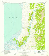
1950 Map of Norton Bay D-4
USGS Topo · Published 1958About this map
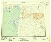
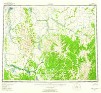
Norton Bay defines the southwestern corner of this coastal Alaskan landscape, where the tides meet a complex system of deltaic wetlands and meandering watercourses. The Koyuk River enters from the northwest, while the Inglutalik River cuts a deep, winding path through the rising terrain to the east before emptying into the bay. This 1950 survey, based on aerial photography from the Army Corps of Engineers, reveals an unpopulated wilderness of tundra and scrub, characterized by hundreds of small lakes and ponds across the coastal plain. The lack of any roads or trails highlights the reliance on these major river corridors for transport and subsistence in the Seward Peninsula region during the mid-century era.
Find a feature on this map
3 named features on this map. Tap any name to fly to it.
Don’t see what you’re looking for? This feature index may not catch every label — zoom into the map to look around manually.
Map Details
Editions of this 1950 Norton Bay D-4 Map
This is the sole edition of this map. No revisions or reprints were ever made.
Other maps of this area
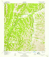
1948 · Norton Bay
USGS Topo · 1:250,000
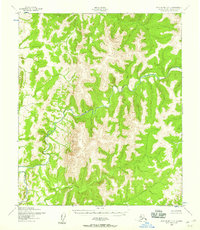
1950 · Norton Bay D-5
USGS Topo · 1:63,360
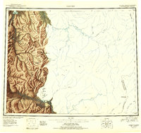
1950 · Candle A-5
USGS Topo · 1:63,360
1950 · Norton Bay C-5
USGS Topo · 1:63,360
1950 · Norton Bay C-3
USGS Topo · 1:63,360
1950 · Norton Bay D-3
USGS Topo · 1:63,360
1950 · Norton Bay C-4
USGS Topo · 1:63,360
1951 · Candle
USGS Topo · 1:250,000

1951 · Norton Bay
USGS Topo · 1:250,000
1955 · Candle
USGS Topo · 1:250,000