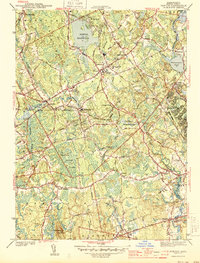
1944 Map of Norton
USGS Topo · Published 1944About this map
The town of Norton and its surrounding Bristol County landscape appear in this mid-war survey, defined by a complex network of waterways and early industrial sites. The Rumford River and Wading River flow through the heart of the area, feeding into the Norton Reservoir and powering local enterprise at the Copper Works and Barrowsville Pond. The presence of Wheaton College anchors the village center, while the eastern edge of the map is dominated by the sprawling wartime infrastructure of Camp Miles Standish.
Find a feature on this map
52 named features on this map. Tap any name to fly to it.
Don’t see what you’re looking for? This feature index may not catch every label — zoom into the map to look around manually.
Map Details
Editions of this 1944 Norton Map
2 editions found
Other maps of this area

1885 · Taunton
USGS Topo · 1:62,500

1886 · Dedham
USGS Topo · 1:62,500

1887 · Franklin
USGS Topo · 1:62,500

1887 · Providence
USGS Topo · 1:62,500

1888 · Taunton
USGS Topo · 1:62,500

1889 · Providence
USGS Topo · 1:62,500

1889 · Franklin
USGS Topo · 1:62,500

1893 · Taunton
USGS Topo · 1:62,500

1893 · Franklin
USGS Topo · 1:62,500

1894 · Dedham
USGS Topo · 1:62,500