
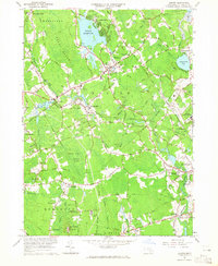
1964 Map of Norton
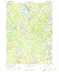
USGS Topo · Published 1979About this map
Wheaton College serves as a focal point for the town of Norton, where education and institutional land use define much of the local character. This mid-century survey illustrates a landscape dominated by the Norton Reservoir and the extensive Great Woods, alongside significant state-run facilities like the Dever State School and the Lovering Colony State Hospital near Oakland. The area's industrial and transport legacy is visible through the Conrail rail lines and numerous Gravel Pits that dot the terrain between Barrowsville and Chartley.
Find a feature on this map
108 named features on this map. Tap any name to fly to it.
Don’t see what you’re looking for? This feature index may not catch every label — zoom into the map to look around manually.
Map Details
Editions of this 1964 Norton Map
3 editions found
Other maps of this area

1885 · Taunton
USGS Topo · 1:62,500

1886 · Dedham
USGS Topo · 1:62,500

1887 · Franklin
USGS Topo · 1:62,500

1887 · Providence
USGS Topo · 1:62,500

1888 · Taunton
USGS Topo · 1:62,500

1889 · Providence
USGS Topo · 1:62,500

1889 · Franklin
USGS Topo · 1:62,500

1893 · Taunton
USGS Topo · 1:62,500

1893 · Franklin
USGS Topo · 1:62,500

1894 · Dedham
USGS Topo · 1:62,500