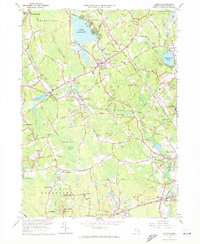
1964 Map of Norton
USGS Topo · Published 1972About this map
Wheaton College sits at the heart of this landscape, surrounded by the village of Norton and the expansive Norton Reservoir. The mid-century terrain is defined by a dense network of waterways, including the Wading River, Canoe River, and Three Mile River, which historically powered the industry of Bristol County. Evidence of this industrial and institutional character is visible in the numerous Gravel Pits and large-scale facilities such as the Dever State School and the Lovering Colony State Hospital.
Find a feature on this map
111 named features on this map. Tap any name to fly to it.
Don’t see what you’re looking for? This feature index may not catch every label — zoom into the map to look around manually.
Map Details
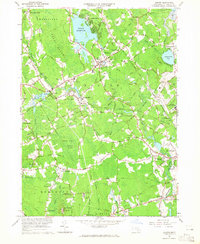
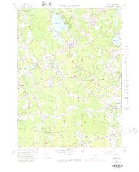
Editions of this 1964 Norton Map
3 editions found
Other maps of this area

1885 · Taunton
USGS Topo · 1:62,500

1886 · Dedham
USGS Topo · 1:62,500

1887 · Franklin
USGS Topo · 1:62,500

1887 · Providence
USGS Topo · 1:62,500

1888 · Taunton
USGS Topo · 1:62,500

1889 · Providence
USGS Topo · 1:62,500

1889 · Franklin
USGS Topo · 1:62,500

1893 · Taunton
USGS Topo · 1:62,500

1893 · Franklin
USGS Topo · 1:62,500

1894 · Dedham
USGS Topo · 1:62,500