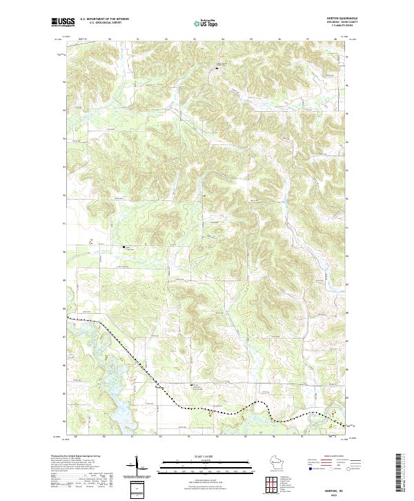
2022 Map of Norton
USGS Topo · Published 2022About this map
Norton stands as a focal point in this portion of Dunn County, situated where the terrain begins to slope toward the southern waterways. The landscape is defined by a dense network of tributaries including Popple Cr, Otter Cr, and Broken Cr, which eventually feed into the larger Hay River and Red Cedar River systems. This drainage pattern shaped the early road network, visible in the way routes like Ridge Rd follow the higher ground between creek valleys.
Find a feature on this map
58 named features on this map. Tap any name to fly to it.
Don’t see what you’re looking for? This feature index may not catch every label — zoom into the map to look around manually.
Map Details
Editions of this 2022 Norton Map
This is the sole edition of this map. No revisions or reprints were ever made.
Other maps of this area

1934 · Elk Mound
USGS Topo · 1:62,500

1936 · Elk Mound
USGS Topo · 1:62,500

1940 · Menomonie
USGS Topo · 1:62,500

1942 · Menomonie
USGS Topo · 1:62,500

1949 · New Auburn
USGS Topo · 1:62,500

1949 · Ridgeland
USGS Topo · 1:62,500

1951 · Ridgeland
USGS Topo · 1:62,500

1951 · New Auburn
USGS Topo · 1:62,500

1953 · Eau Claire
USGS Topo · 1:250,000

1953 · Rice Lake
USGS Topo · 1:250,000