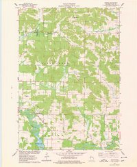
1975 Map of Norton
USGS Topo · Published 1978About this map
Norton stands as a focal point for this rural Dunn County landscape, centered around its local infrastructure including the Norton Ch and Norton Cem. The mid-1970s terrain is defined by its watercourses and conservation lands, with the Hay River and Red Cedar River moving through the southern sections. This period shows a balance between traditional agriculture and recreational development, evidenced by the inclusion of Ski Lifts and the Deepwood Golf Course alongside expansive public lands like the Otter Creek State Fishery Area and State Public Hunting Grounds.
Find a feature on this map
32 named features on this map. Tap any name to fly to it.
Don’t see what you’re looking for? This feature index may not catch every label — zoom into the map to look around manually.
Map Details
Editions of this 1975 Norton Map
This is the sole edition of this map. No revisions or reprints were ever made.
Other maps of this area

1934 · Elk Mound
USGS Topo · 1:62,500

1936 · Elk Mound
USGS Topo · 1:62,500

1940 · Menomonie
USGS Topo · 1:62,500

1942 · Menomonie
USGS Topo · 1:62,500

1949 · New Auburn
USGS Topo · 1:62,500

1949 · Ridgeland
USGS Topo · 1:62,500

1951 · Ridgeland
USGS Topo · 1:62,500

1951 · New Auburn
USGS Topo · 1:62,500

1953 · Eau Claire
USGS Topo · 1:250,000

1953 · Rice Lake
USGS Topo · 1:250,000