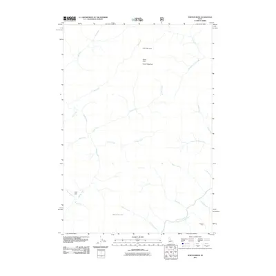
2011 Map of Norton Ridge
USGS Topo · Published 2011About this map
Norton Ridge dominates this high-elevation landscape in Valley County, where the terrain is defined by a dense network of drainages feeding into the Middle Fork Salmon River. The area's geography is anchored by two distinct watchpoints, the Norton Ridge Lookout and Mahoney Creek Lookout, reflecting the historical importance of forest monitoring in this wilderness. While the land is primarily characterized by steep ridges and peaks like Norton Ridge Peak, signs of human settlement appear at the Marble Creek Ranch and Cameron Ranch. A complex system of watercourses, including Marble Creek, Canyon Creek, and Mahoney Creek, carves through the landscape, illustrating the intricate drainage patterns that lead toward the major river corridor at the southern edge of the survey. The presence of these ranches and lookout stations among the অসংখ্য creeks suggests a history of remote ranching and active land management in the central Idaho mountains.
Find a feature on this map
25 named features on this map. Tap any name to fly to it.
Don’t see what you’re looking for? This feature index may not catch every label — zoom into the map to look around manually.
Map Details
Editions of this 2011 Norton Ridge Map
This is the sole edition of this map. No revisions or reprints were ever made.
Other maps of this area

1930 · Casto
USGS Topo · 1:125,000

1957 · Challis
USGS Topo · 1:250,000

1960 · Challis
USGS Topo · 1:250,000

1961 · Greyhound Ridge
USGS Topo · 1:62,500

1962 · Bear Creek Point
USGS Topo · 1:24,000

1962 · Norton Ridge
USGS Topo · 1:24,000

1962 · Shellrock Peak
USGS Topo · 1:24,000

1962 · Ramey Hill
USGS Topo · 1:24,000

1963 · Challis
USGS Topo · 1:250,000
1963 · Sliderock Ridge
USGS Topo · 1:24,000