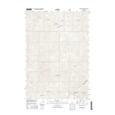
2013 Map of Norton Ridge
USGS Topo · Published 2013About this map
Norton Ridge dominates the skyline of this central Idaho landscape, where the high-altitude divide separates the drainages of the Boise National Forest and Challis National Forest. The map reflects a remote wilderness character defined by its dramatic elevation changes, punctuated by tactical vantage points like the Norton Ridge Lookout and Mahoney Creek Lookout. Human activity is sparse and concentrated near water sources, evidenced by the Marble Creek Ranch and Cameron Ranch along the southern reaches of the quadrangle. The intricate drainage network of Mahoney Cr and Marble Cr feeds eventually toward the Middle Fork Salmon River, which cuts through the southeastern corner. This survey documents the intersection of Valley and Custer counties during the early 21st century, providing a clear record of forest service land management and natural topography.
Find a feature on this map
41 named features on this map. Tap any name to fly to it.
Don’t see what you’re looking for? This feature index may not catch every label — zoom into the map to look around manually.
Map Details
Editions of this 2013 Norton Ridge Map
This is the sole edition of this map. No revisions or reprints were ever made.
Other maps of this area

1930 · Casto
USGS Topo · 1:125,000

1957 · Challis
USGS Topo · 1:250,000

1960 · Challis
USGS Topo · 1:250,000

1961 · Greyhound Ridge
USGS Topo · 1:62,500

1962 · Bear Creek Point
USGS Topo · 1:24,000

1962 · Norton Ridge
USGS Topo · 1:24,000

1962 · Shellrock Peak
USGS Topo · 1:24,000

1962 · Ramey Hill
USGS Topo · 1:24,000

1963 · Challis
USGS Topo · 1:250,000
1963 · Sliderock Ridge
USGS Topo · 1:24,000