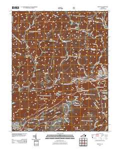
2011 Map of Norton
USGS Topo · Published 2011About this map
The Powell River and its numerous tributaries, including Black Creek and Butcher Fork, carve through the complex terrain of Wise County, defining a landscape of narrow hollows and prominent ridges. Small settlements like Blackwood, Josephine, and Dorchester cluster along the valley floors, linked by a network of roads that snake through gaps such as Buffalo Gap and Benges Gap. The industrial and civic development of the area is evident in the presence of Kent Junction and Dorchester Junction, while the surrounding heights are marked by landmarks like the Stonega Lookout Tower and High Knob Lookout Tower. Numerous family cemeteries, such as the Stidham Cemetery, Treadway Cemetery, and Wells Cemetery, are scattered across the slopes, offering significant value for genealogical research. Water management is a key feature of the topography, with the Upper Norton Reservoir and Lower Norton Reservoir situated near the city of Norton.
Find a feature on this map
124 named features on this map. Tap any name to fly to it.
Don’t see what you’re looking for? This feature index may not catch every label — zoom into the map to look around manually.
Map Details
Editions of this 2011 Norton Map
This is the sole edition of this map. No revisions or reprints were ever made.
Other maps of this area

1890 · Whitesburg
USGS Topo · 1:125,000

1892 · Whitesburg
USGS Topo · 1:125,000

1894 · Estillville
USGS Topo · 1:125,000

1912 · Pound
USGS Topo · 1:48,000

1913 · Oven Fork
USGS Topo · 1:48,000

1914 · Pound
USGS Topo · 1:62,500

1915 · Whitesburg
USGS Topo · 1:62,500

1920 · Wise
USGS Topo · 1:48,000

1921 · Big Stone Gap
USGS Topo · 1:48,000

1921 · Wise
USGS Topo · 1:62,500