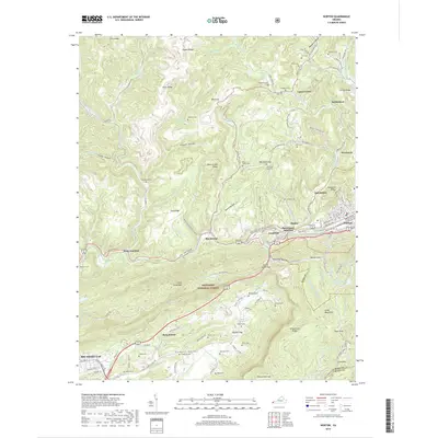
2019 Map of Norton
USGS Topo · Published 2019About this map
Jefferson National Forest dominates the high-elevation terrain of this Wise County study, where the steep ridges of Little Stone Mtn and Stone Mountain overlook the industrial corridors of the Powell River valley. The map documents a dense network of coal-country settlements and rail infrastructure, centered around Dorchester Junction and the western edge of Norton. Small communities like Josephine, Blackwood, and Sutherland are connected by the CSX line and the Blackwood Industrial Park Rd. The landscape is dotted with numerous family burial grounds, including the Wampler Cem, Skeen Cem, and Treadway Cem, reflecting generations of residence in Powell Valley. High-altitude features such as High Knob and Rimrock Lake stand in contrast to the developed lowlands near Big Stone Gap, illustrating the complex relationship between the wilderness of the Jefferson National Forest and the region's extractive history.
Find a feature on this map
162 named features on this map. Tap any name to fly to it.
Don’t see what you’re looking for? This feature index may not catch every label — zoom into the map to look around manually.
Map Details
Editions of this 2019 Norton Map
This is the sole edition of this map. No revisions or reprints were ever made.
Other maps of this area

1890 · Whitesburg
USGS Topo · 1:125,000

1892 · Whitesburg
USGS Topo · 1:125,000

1894 · Estillville
USGS Topo · 1:125,000

1912 · Pound
USGS Topo · 1:48,000

1913 · Oven Fork
USGS Topo · 1:48,000

1914 · Pound
USGS Topo · 1:62,500

1915 · Whitesburg
USGS Topo · 1:62,500

1920 · Wise
USGS Topo · 1:48,000

1921 · Big Stone Gap
USGS Topo · 1:48,000

1921 · Wise
USGS Topo · 1:62,500