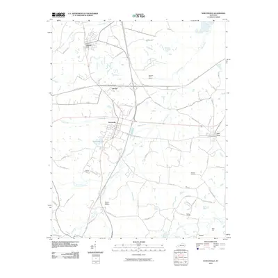
2010 Map of Nortonville
USGS Topo · Published 2010About this map
Nortonville and Mortons Gap serve as the primary hubs in this western Kentucky landscape, where the transport corridor of the Pennyrile Pkwy and Western Kentucky Pkwy intersects. The terrain is defined by a dense network of watercourses, including Drakes Creek and Craborchard Creek, which weave through a countryside marked by family history and small-scale infrastructure. Genealogists will find a significant concentration of burial sites throughout the quadrangle, such as Whitfield Cemetery and McIntosh Cemetery, alongside McIntosh Church. To the south, the appearance of Dragline Rd and Pleasant Hill Mine Rd hints at the industrial heritage of the area, while Rich Hill rises as a prominent landmark near the southern boundary. Small settlements like Oak Hill and White Plains further illustrate the established rural community structure of the early 21st century.
Find a feature on this map
59 named features on this map. Tap any name to fly to it.
Don’t see what you’re looking for? This feature index may not catch every label — zoom into the map to look around manually.
Map Details
Editions of this 2010 Nortonville Map
This is the sole edition of this map. No revisions or reprints were ever made.
Other maps of this area

1907 · Earlington
USGS Topo · 1:48,000

1909 · Dawson Springs
USGS Topo · 1:48,000

1909 · Earlington
USGS Topo · 1:62,500

1909 · Madisonville
USGS Topo · 1:62,500

1911 · Dawson Springs
USGS Topo · 1:62,500

1912 · Nortonville
USGS Topo · 1:62,500

1952 · Crofton
USGS Topo · 1:24,000

1953 · Dawson Springs SE
USGS Topo · 1:24,000

1953 · Haleys Mill
USGS Topo · 1:24,000

1953 · Nortonville
USGS Topo · 1:24,000