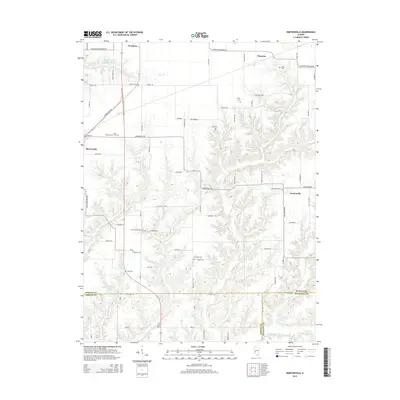
2015 Map of Nortonville
USGS Topo · Published 2015About this map
Murrayville Woodson Lake and the headwaters of Henry Cr define the northern landscape of this Central Illinois region. The terrain transitions from the relatively flat farmland near Woodson to the more dissected, stream-cut valleys of the south, where the meeting of Morgan, Greene, and Macoupin counties occurs. Numerous family and community burial grounds, such as Roberts Cem, Sooy Cem, and Whitlock Cem, are scattered across the township, providing essential spatial data for genealogical research.
Find a feature on this map
80 named features on this map. Tap any name to fly to it.
Don’t see what you’re looking for? This feature index may not catch every label — zoom into the map to look around manually.
Map Details
Editions of this 2015 Nortonville Map
This is the sole edition of this map. No revisions or reprints were ever made.
Other maps of this area

1924 · Winchester
USGS Topo · 1:48,000

1924 · Roodhouse
USGS Topo · 1:62,500

1926 · Winchester
USGS Topo · 1:62,500

1926 · Roodhouse
USGS Topo · 1:62,500

1932 · Greenfield
USGS Topo · 1:62,500

1932 · Jacksonville
USGS Topo · 1:62,500

1937 · Jacksonville
USGS Topo · 1:62,500

1948 · Quincy
USGS Topo · 1:250,000

1956 · Quincy
USGS Topo · 1:250,000
1983 · Manchester
USGS Topo · 1:24,000