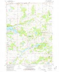
1980 Map of Norvell
USGS Topo · Published 1981About this map
The Sharonville State Wildlife Management Area anchors the eastern edge of this landscape, where the Jackson Co Washtenaw Co border divides rural townships. In the southwest, Napoleon is marked by its proximity to several Gravel Pits and quarries, while the Conrail line skirts the northern boundary near Michigan Avenue. This region is characterized by a dense concentration of kettle lakes and wetlands, including Wolf Lake, Suezey Lake, and Norvell Lake, which are interconnected by the winding Raisin River.
Find a feature on this map
50 named features on this map. Tap any name to fly to it.
Don’t see what you’re looking for? This feature index may not catch every label — zoom into the map to look around manually.
Map Details
Editions of this 1980 Norvell Map
2 editions found
Other maps of this area

1919 · Stockbridge
USGS Topo · 1:62,500

1919 · Rives Junction
USGS Topo · 1:62,500

1921 · Rives Junction
USGS Topo · 1:62,500

1922 · Stockbridge
USGS Topo · 1:62,500

1935 · Jackson
USGS Topo · 1:48,000

1939 · Jackson
USGS Topo · 1:62,500

1942 · Stockbridge
USGS Topo · 1:62,500

1948 · Manchester
USGS Topo · 1:62,500

1949 · Manchester
USGS Topo · 1:62,500

1958 · Grand Rapids
USGS Topo · 1:250,000