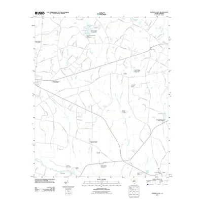
2011 Map of Norway East
USGS Topo · Published 2011About this map
Bolen Town and the village of Cope anchor this landscape in Orangeburg County, where agricultural lands meet a dense network of blackwater drainages. The southern border follows the winding course of the South Fork Edisto River, featuring distinctive landmarks like Old Forty Acre Island, Snow Island, and the riverside Hutto Landing. The area is characterized by numerous swamps and branches, including Deadfall Swamp and Scratchnose Swamp, which historically influenced the placement of roads and homesteads. Local history is preserved in several rural burial grounds such as Cherry Hill Cemetery, Two Mile Cemetery, and Old Union Cemetery. The presence of many small impoundments and mill ponds, notably Fogle Mill Pond and Copes Pond, reflects the local importance of water management for both industry and recreation in this part of South Carolina.
Find a feature on this map
112 named features on this map. Tap any name to fly to it.
Don’t see what you’re looking for? This feature index may not catch every label — zoom into the map to look around manually.
Map Details
Editions of this 2011 Norway East Map
This is the sole edition of this map. No revisions or reprints were ever made.
Other maps of this area

1919 · Bamberg
USGS Topo · 1:48,000

1920 · Bamberg
USGS Topo · 1:62,500

1920 · Orangeburg
USGS Topo · 1:48,000

1921 · Orangeburg
USGS Topo · 1:62,500

1943 · Bamberg
USGS Topo · 1:62,500

1943 · Orangeburg
USGS Topo · 1:125,000

1943 · Orangeburg
USGS Topo · 1:62,500

1946 · Woodford
USGS Topo · 1:62,500

1946 · St. Matthews
USGS Topo · 1:62,500

1954 · Augusta
USGS Topo · 1:250,000