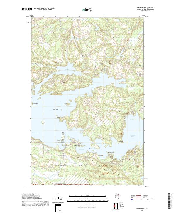
2022 Map of Norwegian Bay
USGS Topo · Published 2022About this map
Norwegian Bay and the surrounding reaches of Vermilion Lake define this intricate shoreline in northern Minnesota. The geography is dominated by a complex network of points, islands, and narrow passages that have long served as a seasonal retreat and recreational hub. Landmarks like Holmbo Island, Goodwill Island, and Treasure Island punctuate the open water, while the southern landscape is traversed by the David Dill-Arrowhead State Trail.
Find a feature on this map
64 named features on this map. Tap any name to fly to it.
Don’t see what you’re looking for? This feature index may not catch every label — zoom into the map to look around manually.
Map Details
Editions of this 2022 Norwegian Bay Map
This is the sole edition of this map. No revisions or reprints were ever made.
Other maps of this area

1954 · Hibbing
USGS Topo · 1:250,000

1954 · International Falls
USGS Topo · 1:250,000

1956 · Vermilion Dam
USGS Topo · 1:24,000

1956 · Lost Lake
USGS Topo · 1:24,000

1957 · Hibbing
USGS Topo · 1:250,000

1957 · International Falls
USGS Topo · 1:250,000

1958 · International Falls
USGS Topo · 1:250,000

1958 · Hibbing
USGS Topo · 1:250,000

1963 · Picket Lake
USGS Topo · 1:24,000

1964 · Hibbing
USGS Topo · 1:250,000