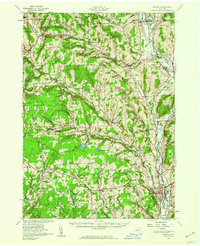
1944 Map of Norwich
USGS Topo · Published 1960About this map
Norwich serves as the primary hub of this Chenango County landscape, situated along the Chenango River where the New York Ontario and Western RR and Delaware Lackawanna and Western RR intersect. The topography is defined by the steep divides of Tinker Ridge and several high hills such as Negro Hill and Sawmill Hill. This era shows a distributed rural society organized around a dense network of district schools, from School No 6 in the north to School No 12 near Preston. Large tracts of land are dedicated to conservation and state management, most notably the Pharsalia Game Refuge and the Slate Game Farm. Local heritage is preserved in numerous burial grounds including the Quaker Cem and Reynolds Cem, while smaller settlements like Sherburne Four Corners and South Plymouth anchor the valleys.
Find a feature on this map
95 named features on this map. Tap any name to fly to it.
Don’t see what you’re looking for? This feature index may not catch every label — zoom into the map to look around manually.
Map Details
Editions of this 1944 Norwich Map
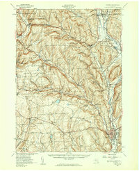
2 editions found
Other maps of this area

1897 · Cazenovia
USGS Topo · 1:62,500

1899 · Cazenovia
USGS Topo · 1:62,500

1902 · Coventry
USGS Topo · 1:62,500

1902 · Morrisville
USGS Topo · 1:62,500

1903 · Norwich
USGS Topo · 1:62,500

1904 · Greene
USGS Topo · 1:62,500

1904 · Oxford
USGS Topo · 1:62,500

1904 · Pitcher
USGS Topo · 1:62,500

1907 · Sangerfield
USGS Topo · 1:62,500

1910 · New Berlin
USGS Topo · 1:62,500