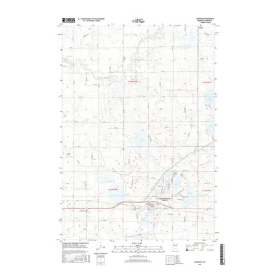
2016 Map of Norwood
USGS Topo · Published 2016About this map
Norwood Young America serves as the primary hub of this Carver County landscape, where the confluence of historic town plats is reflected in a dense concentration of civic sites. The area is notable for its high density of burial grounds, including the Crow River Cem to the north and the Church of the Ascension Catholic Cem within the main settlement. The landscape is defined by the winding course of the South Fork Crow River and a chain of glacial lakes such as Eagle Lake, Baylor Lake, and Young America Lake. A sophisticated grid of county roads and local streets like Tacoma Blvd and Railroad St connects these water bodies with agricultural fields and landmarks like Ziermann Airport, illustrating the modern balance between rural heritage and residential growth.
Find a feature on this map
58 named features on this map. Tap any name to fly to it.
Don’t see what you’re looking for? This feature index may not catch every label — zoom into the map to look around manually.
Map Details
Editions of this 2016 Norwood Map
This is the sole edition of this map. No revisions or reprints were ever made.
Other maps of this area

1953 · Saint Paul
USGS Topo · 1:250,000

1953 · New Ulm
USGS Topo · 1:250,000

1957 · New Ulm
USGS Topo · 1:250,000

1957 · Belle Plaine
USGS Topo · 1:62,500

1957 · Waconia
USGS Topo · 1:62,500

1958 · New Ulm
USGS Topo · 1:250,000

1958 · Gaylord
USGS Topo · 1:62,500

1958 · Glencoe
USGS Topo · 1:62,500

1959 · Saint Paul
USGS Topo · 1:250,000

1967 · New Ulm
USGS Topo · 1:250,000
Featured Places
- Norwood Young America, MN
- Young America, Norwood Young America
- Young America Township, MN
- Norwood, Norwood Young America
- Benton Township, MN