
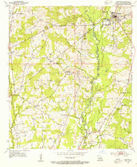
1941 Map of Norwood
USGS Topo · Published 1941About this map
East Feliciana Parish rural life in 1941 is documented through a dense network of country churches and schools along the Mississippi border. The Illinois Central Railroad, also identified here as the Yazoo and Mississippi Valley, serves as the primary transport spine for the settlements of Norwood and Wilson. The landscape is defined by the winding course of the Comite River and its numerous tributaries, including Beechem Bayou and Richland Creek.
Find a feature on this map
43 named features on this map. Tap any name to fly to it.
Don’t see what you’re looking for? This feature index may not catch every label — zoom into the map to look around manually.
Map Details
Editions of this 1941 Norwood Map
This is the sole edition of this map. No revisions or reprints were ever made.
Other maps of this area

1906 · Bayou Sara
USGS Topo · 1:125,000

1941 · Woodland
USGS Topo · 1:31,680

1941 · Lost Creek
USGS Topo · 1:31,680

1945 · Norwood
USGS Topo · 1:31,680

1945 · Jackson
USGS Topo · 1:31,680

1945 · Lost Creek
USGS Topo · 1:31,680

1946 · Clinton
USGS Topo · 1:31,680

1949 · Bluff Creek
USGS Topo · 1:31,680

1953 · Natchez
USGS Topo · 1:250,000
1954 · Clinton
USGS Topo · 1:24,000