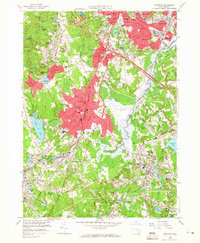
1958 Map of Norwood
USGS Topo · Published 1966About this map
Norwood and its surrounding communities are depicted here during a period of significant post-war expansion in Norfolk County. The Neponset River valley serves as the central geographic axis, winding past the Norwood Memorial Airport and through a series of industrial and residential nodes. The transportation network is dominated by the intersection of the Yankee Division Highway and the Providence Highway, alongside the tracks of the New York New Haven and Hartford railroad.
Find a feature on this map
118 named features on this map. Tap any name to fly to it.
Don’t see what you’re looking for? This feature index may not catch every label — zoom into the map to look around manually.
Map Details
Editions of this 1958 Norwood Map
2 editions found
Other maps of this area

1886 · Dedham
USGS Topo · 1:62,500

1886 · Framingham
USGS Topo · 1:62,500

1887 · Franklin
USGS Topo · 1:62,500

1889 · Franklin
USGS Topo · 1:62,500

1889 · Framingham
USGS Topo · 1:62,500

1893 · Franklin
USGS Topo · 1:62,500

1893 · Boston
USGS Topo · 1:62,500

1894 · Dedham
USGS Topo · 1:62,500

1894 · Framingham
USGS Topo · 1:62,500

1903 · Boston
USGS Topo · 1:62,500