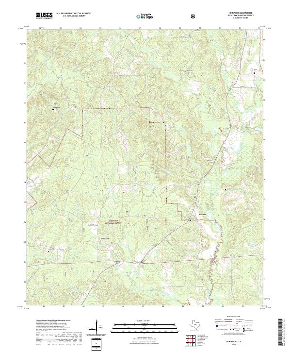
2022 Map of Norwood
USGS Topo · Published 2022About this map
Angelina National Forest encompasses much of this East Texas terrain, where timberlands and creek drainages define the rural layout of San Augustine County. Small settlements like Norwood and Macune serve as local anchors within a landscape dissected by numerous watercourses, including the westward-flowing Hardikner Cr and the prominent Ayish Bayou on the eastern edge. This 2022 survey documents a persistent network of family-named cemeteries that speak to the area's deep-rooted genealogical heritage. Significant sites such as the Maryland Cem, Solomon Miller Cem, and Union Grove Cem are preserved alongside modern forestry roads. The drainage patterns of Turkey Cr and Lick Br illustrate the complex hydrology that historically influenced land use and the development of the timber industry in this pocket of the Piney Woods.
Find a feature on this map
52 named features on this map. Tap any name to fly to it.
Don’t see what you’re looking for? This feature index may not catch every label — zoom into the map to look around manually.
Map Details
Editions of this 2022 Norwood Map
This is the sole edition of this map. No revisions or reprints were ever made.
Other maps of this area

1953 · Palestine
USGS Topo · 1:250,000

1957 · Palestine
USGS Topo · 1:250,000

1958 · Broaddus
USGS Topo · 1:62,500

1958 · San Augustine
USGS Topo · 1:62,500

1958 · Martinsville
USGS Topo · 1:62,500

1958 · Bronson
USGS Topo · 1:62,500

1984 · Norwood
USGS Topo · 1:24,000
1984 · Chireno South
USGS Topo · 1:24,000
1984 · Harvey Creek
USGS Topo · 1:24,000
1984 · Chinquapin
USGS Topo · 1:24,000