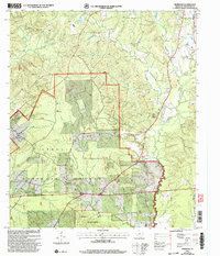
2003 Map of Norwood
USGS Topo · Published 2004About this map
Angelina National Forest covers a significant portion of this terrain in East Texas, shaping the development and layout of the landscape as it appeared in the early 2000s. The small settlement of Norwood sits at the heart of the region, served by the Norwood School and a network of arterial paths such as the National Forest Road. This survey documents the intersection of public forest lands and local rural life, illustrating how geographic boundaries and land management by the USDA Forest Service defined the community's footprint. It provides a specific record of local infrastructure and forest administration before modern developments altered the character of these wooded tracts.
Find a feature on this map
4 named features on this map. Tap any name to fly to it.
Don’t see what you’re looking for? This feature index may not catch every label — zoom into the map to look around manually.
Map Details
Editions of this 2003 Norwood Map
This is the sole edition of this map. No revisions or reprints were ever made.
Other maps of this area

1953 · Palestine
USGS Topo · 1:250,000

1957 · Palestine
USGS Topo · 1:250,000

1958 · Broaddus
USGS Topo · 1:62,500

1958 · San Augustine
USGS Topo · 1:62,500

1958 · Martinsville
USGS Topo · 1:62,500

1958 · Bronson
USGS Topo · 1:62,500

1984 · Norwood
USGS Topo · 1:24,000
1984 · Chireno South
USGS Topo · 1:24,000
1984 · Harvey Creek
USGS Topo · 1:24,000
1984 · Chinquapin
USGS Topo · 1:24,000