
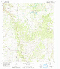
1967 Map of Novice West
USGS Topo · Published 1969About this map
The boundary between Runnels Co Coleman Co bisects this landscape of West Texas ranching and oil production during the late 1960s. The settlement of Novice sits in the northeast corner, served by the Atchison Topeka and Santa Fe railroad and the waters of Novice City Lake. The terrain is defined by the winding drainages of Jim Ned Creek and its southern fork, while the prominent Blue Gap stands out in the northwest. Local history is anchored by Atoka Cem and Crews Cem, providing essential markers for genealogical research.
Find a feature on this map
27 named features on this map. Tap any name to fly to it.
Don’t see what you’re looking for? This feature index may not catch every label — zoom into the map to look around manually.
Map Details
Editions of this 1967 Novice West Map
2 editions found
Other maps of this area

1890 · Abilene
USGS Topo · 1:125,000

1892 · Abilene
USGS Topo · 1:125,000

1892 · Ballinger
USGS Topo · 1:125,000

1954 · Brownwood
USGS Topo · 1:250,000

1954 · Abilene
USGS Topo · 1:250,000

1958 · Abilene
USGS Topo · 1:250,000

1967 · Talpa
USGS Topo · 1:24,000
1967 · Novice East
USGS Topo · 1:24,000
1967 · Valera
USGS Topo · 1:24,000
1967 · McEwen Draw
USGS Topo · 1:24,000