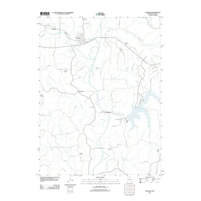
2012 Map of Novinger
USGS Topo · Published 2012About this map
The Chariton River carves a central path through this Missouri landscape, anchoring a series of small settlements including Novinger, Tipperary, and Youngstown. The eastern portion of the map is dominated by the sprawling waters of Forest Lake, held by the Forest Lake Dam, creating a distinct contrast to the agricultural and wooded uplands to the west. Evidence of the region’s long-standing community roots is found in the dense distribution of burial grounds, such as Mount Moriah Cemetery and Pinkerton Cemetery, which are scattered among the creek drainages of Billy Creek and Hog Creek.
Find a feature on this map
78 named features on this map. Tap any name to fly to it.
Don’t see what you’re looking for? This feature index may not catch every label — zoom into the map to look around manually.
Map Details
Editions of this 2012 Novinger Map
This is the sole edition of this map. No revisions or reprints were ever made.
Other maps of this area

1911 · Queen City
USGS Topo · 1:62,500

1912 · Green City
USGS Topo · 1:62,500

1913 · Queen City
USGS Topo · 1:62,500

1914 · Green City
USGS Topo · 1:62,500

1938 · Kirksville
USGS Topo · 1:62,500

1940 · Kirksville
USGS Topo · 1:62,500

1954 · Centerville
USGS Topo · 1:250,000

1957 · Centerville
USGS Topo · 1:250,000

1958 · Centerville
USGS Topo · 1:250,000

1963 · Pure Air
USGS Topo · 1:24,000